Wed
20 Jun 2018Modern-Ancient Ocean Crust Project
Metal Oceans studies modern ocean environments to provide insights to ore deposits in the Superior Craton.
An interview with Research Associate Margaret Stewart from Metal Oceans, a partner of Metal Earth at the University of Ottawa.

Figure 1: Bathymetric map of the northern Lau Basin showing its complex geology and structure. (Source: Global Multi-Resolution Topography Data Synthesis).
Mark Hannington, Margaret Stewart and Justin Emberley from the research project Metal Oceans at the University of Ottawa has partnered with Metal Earth to provide insights to ore deposits in the Superior Craton. Metal Earth seeks answers to fundamental questions related to how secular changes in Earth’s evolution have resulted in differential metal endowment in space and in time in the Precambrian shield. Metal Oceans studies modern ocean environments to develop an understanding of the factors that localize deposits on the sea floor. They will then be able to take these learnings and apply them to the ancient deposits in the Abitibi in the Superior Craton.
|
|
The present is the key to the past.The sea floor presents research opportunities to study mineral deposits since the ocean crust is still undergoing processes and actively forming ore deposits today. Metal Oceans will develop a comparison for Metal Earth to allow for a more thorough understanding of how ore deposits may have developed billions of years ago. |
|
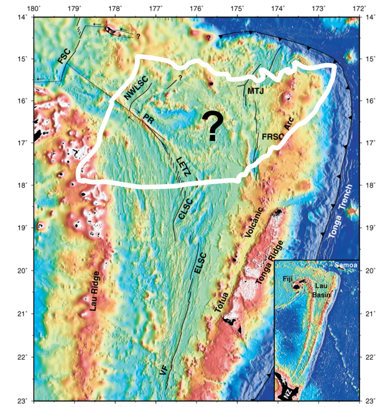
Figure 2: Bathymetric map of the Lau Basin showing major spreading centers and structures. White line represents the outline of the Abitibi greenstone belt at the same scale as the bathymetric map. Many complex structures and geologic domains occur within an area the size of the Abitibi greenstone belt. |

“It’s like a puzzle. On land, you have all the pieces in a pile whereas on the sea floor, the pieces are already put together”.
The advantage of studying the seafloor is that it provides the opportunity to observe the different stages throughout the mineralization process. Deposits currently on land initially formed in ancient oceans and represent the culmination of these processes, making it difficult for the Metal Earth team to study the distinct stages of mineralization. Throughout the modern oceans, different stages in the mineralization process are currently taking place in different plate tectonic settings and can be observed and compared to the ancient deposits currently on land.
“We need to come up with new ways to identify prospective areas on land. We are looking at the modern environments of the ocean to try and better inform what processes could have been happening billion of years ago".
The Lau Basin.The Metal Oceans team set out to identify a location on the sea floor that held similar characteristics to that of the Abitibi in the Superior Craton. With a giant volume of ocean crust, only a very small portion of that crust will end up hosting deposits. They considered tectonic environments, rock and deposit types to end up in the Northern tip of the Lau Basin surrounding Fiji. The project will be specifically studying VMS deposits (zinc, copper, lead, gold) utilizing geophysics and geological mapping. |
|
|
|
Figure 3: Photo 3: Map of the Melanesian Archipelago in the SW Pacific Ocean. Green areas are above sea level and brown areas have shallow water depths due to thickened crust. Yellow stars indicate the primary study areas for the project (Bismarck Archipelago and New Ireland Basin; New Hebridges and North Fiji Basin; Lau Basin). |

Research Expedition
The Metal Oceans team will head out on the research vessel on December 10th, 2018 and will return January 27th, 2019 with up to 40 scientists and 30 crew members. Instruments will be used to measure the magnetic signatures of rocks, heat flow through the crust, and the deep structure of the oceanic crust. They will be mapping the topography of the seafloor, collecting rock and sediment samples, and identifying plumes in the water column that may indicate areas where metals are being deposited on the seafloor.
 |
 |
 |
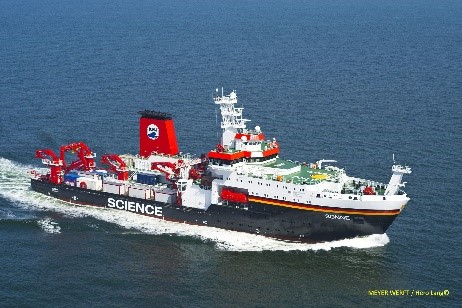
| Figure 4: Image of the German research vessel, the RV Sonne. (Source: MEYER WERFT/Hero Lang)
|
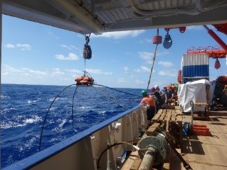
Figure 5: Image of an ocean bottom magnetotellurics instrument. | Figure 6: Image of a streamer used to collect seismic data. |
Project Outcomes
This fall, the Metal Oceans team will release a geological map of the Lau Basin. This will be one of the first geological maps of the sea floor. After the collection of data is complete in January, they will be analyzing and interpreting the data to be able to start making comparisons with the Metal Earth team in the spring of 2019.

